Thinking about an industrial or business park move near the Rio Vista Airport? You want lower land costs without losing regional reach, but you also need clear answers on access, utilities, and environmental risk. In this guide, you’ll learn where opportunities cluster, what constraints to expect, and how to underwrite a Rio Vista deal with confidence. Let’s dive in.
Why Rio Vista can work
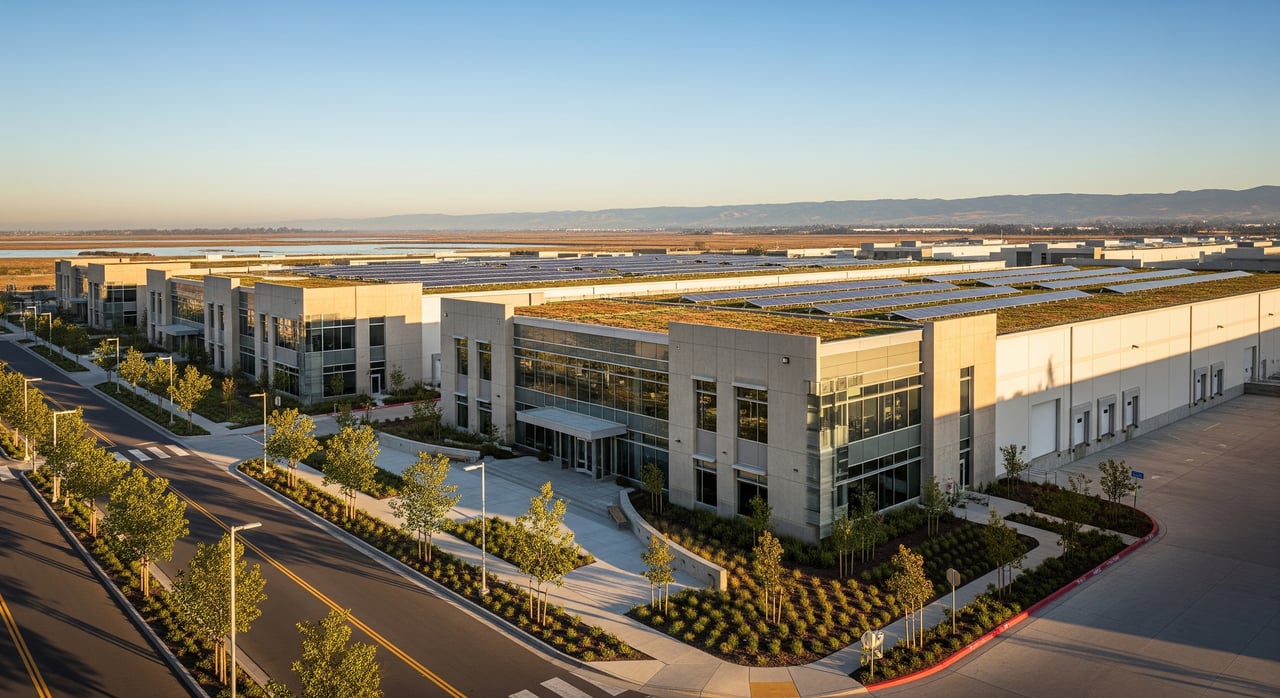
Rio Vista sits on the western edge of the Sacramento–San Joaquin River Delta in eastern Solano County. The airport-adjacent area supports light industrial, aviation-related, and logistics uses. The draw is simple: comparatively lower land costs than core Bay Area markets and proximity to the Bay Area, Sacramento Valley, and Central Valley supply chains.
At the same time, plan for tradeoffs. The local labor pool is smaller than larger metros, and access relies on regional roads rather than direct interstate frontage. If your use can tolerate slightly longer hauls and values cost-effective land, this submarket may be a fit.
Transportation access and trucking reality
SR-12 is the primary east–west arterial serving Rio Vista. Westbound SR-12 connects toward the I-80 corridor at Fairfield/Suisun City, while eastbound SR-12 and connector roads head toward I-5 and Central Valley markets. For projects that generate heavy truck traffic, build a realistic travel-time model to major interchanges and intermodal nodes during peak and off-peak periods.
Because SR-12 includes two-lane segments and local roads, any high-trip project should include a truck-route analysis and early coordination with Caltrans on access design and potential improvements. Review corridor information and encroachment permit guidance directly from Caltrans.
Airport adjacency: what it enables
Rio Vista has a city-owned general aviation airport next to the business/industrial area. It supports light and business aviation rather than large-scale air cargo. This creates niche opportunities: aircraft maintenance and overhaul, avionics, corporate hangars, flight training, parts and avionics distribution, and time-sensitive last-mile logistics.
Before you size an aviation program, confirm runway length, pavement classifications, and services through the FAA and the City. Start with FAA Airport Data and coordinate locally with the City of Rio Vista’s airport team via the City of Rio Vista.
Zoning, overlays, and entitlements
Expect Business Park/Industrial Park or light industrial zoning near the airport with typical allowances for light manufacturing, warehousing, and aviation-support uses. Performance standards (noise, emissions, hours), height, lot coverage, setbacks, and parking will be defined in the municipal code. Some fringe parcels may fall under county jurisdiction or special airport and floodplain overlays.
Common approvals include parcel maps, site plan and architectural review, and conditional use permits for certain operations. Where the airport overlay applies, you will likely need an Airport Land Use Compatibility (ALUC) review. If wetlands, sensitive habitat, cultural resources, or hydrology are implicated, plan for federal, state, and local permits alongside CEQA review. In a small city with Delta-related environmental constraints, entitlements can range from many months to multiple years.
- Start with the City of Rio Vista Planning and Public Works pages for zoning maps, codes, and application procedures.
- For county jurisdiction or parcel data, consult Solano County.
Utilities and capacity due diligence
Utility availability and timing can make or break feasibility. Solano County’s primary utility provider is PG&E for electric and natural gas. The City of Rio Vista provides municipal water and sewer within city limits. Telecom may be served by regional carriers; confirm fiber and redundancy options.
For underwriting, obtain written capacity letters covering distribution locations, available capacity, required service sizes, connection fees, and interconnection timelines. Large refrigeration or process loads can trigger on-site transformers and longer lead times.
- Electric and gas: PG&E
- Water and sewer: City of Rio Vista
Flood, soils, and site work
A significant portion of the Delta and nearby lands rely on levees and may fall within FEMA flood zones. Flood insurance, elevation requirements, and design features like freeboard can materially affect your budget. Always confirm flood status with the FEMA Flood Map Service Center and review levee conditions with local agencies.
Delta soils can include soft peat and organic layers with high compressibility and low bearing capacity. You may need deep foundations, ground improvement, or engineered fill. Commission a Phase I ESA and geotechnical investigation early to identify differential settlement risks and foundation strategies.
- Check flood zones: FEMA Flood Map Service Center
Stormwater and environmental permitting
Low-lying topography often requires robust drainage design, detention, and on-site treatment that meets local stormwater rules and regional permits. Construction-phase erosion control is standard.
Environmental constraints can include wetlands, riparian habitat, and listed species. Typical permits include Clean Water Act Section 404 through the U.S. Army Corps of Engineers, CDFW 1602 Streambed Alteration, and 401 Water Quality Certification through the Regional Water Board. Expect cultural resources review under CEQA where appropriate.
- Wetlands and federal permitting: U.S. Army Corps of Engineers
- Habitat and state permits: California Dept. of Fish & Wildlife
- Water quality certifications: Regional Water Board
Where opportunities cluster
- Aviation support: Hangars, MRO, avionics, flight schools, and parts distribution adjacent to or near airport parcels.
- Light manufacturing and fabrication: Non-noxious operations that can function with regional highway access rather than interstate frontage.
- Equipment yards and contractor storage: Construction, marine/river equipment, landscaping, and heavy equipment staging with secure yards.
- Agri-processing and cold/packaging: Smaller-scale processing and packaging connected to Delta and Central Valley supply chains; verify water and power.
- Renewable energy O&M and storage: Operations and maintenance facilities supporting nearby wind and solar installations.
- Limited-scale trucking and transload: Regional transfer facilities sized to road conditions; large distribution centers are constrained by access, utilities, and site work.
Underwriting checklist you can use today
Site and regulatory
- Confirm city vs. county jurisdiction and get current zoning, allowable uses, and performance standards.
- Check ALUC compatibility and airport-overlay restrictions.
- Review FEMA panels and levee status; calculate finished-floor elevations and insurance implications.
- Screen for wetlands, habitat, and cultural resources that may trigger federal and state permits.
- Verify General Plan and any specific plan designations or planned infrastructure upgrades.
Utilities and infrastructure
- Secure written capacity letters for electric, gas, water, and sewer with cost and schedule.
- Confirm fiber availability and options for redundant connectivity.
- Identify stormwater requirements, detention volumes, and treatment standards.
Physical and environmental
- Commission a Phase I ESA; proceed to Phase II if red flags appear.
- Complete a geotechnical investigation for soils, bearing capacity, groundwater, and foundation recommendations.
- Conduct wetland delineation and biological assessments.
- Scope cultural resources surveys if CEQA triggers apply.
Access and traffic
- Test truck turning templates and access geometry; evaluate off-site improvements or encroachment permits for SR-12.
- Prepare a Traffic Impact Analysis for high-trip projects.
- Model drive times to I-80, I-5, intermodal terminals, and ports at multiple times of day.
Costs and timelines
- Estimate off-site road improvements, utility extensions, on-site grading, and stormwater systems.
- Budget for flood mitigation, levee considerations, and required freeboard.
- Include environmental mitigation, permitting fees, and CEQA schedule.
- Forecast insurance premiums for flood and environmental liability.
Financial and market
- Gather local comps and lease rates; if scarce, use peripheral Solano markets for context.
- Map labor availability and likely commute sheds for your operation.
- Estimate vacancy risk and demand depth for your specific use case.
Permitting and approvals
- Establish a CEQA baseline and identify potential EIR triggers.
- Map likely federal and state permits and their typical timelines.
Red flags that change the math
- FEMA AE or V zone without a cost-effective path to elevation or floodproofing.
- Significant wetlands or habitat that reduce usable acreage or require extensive mitigation.
- Utility capacity shortfalls that require long-lead upgrades or extensions.
- Deep peat soils that push you toward pile foundations or major ground improvement.
- Inefficient truck routing, narrow local roads, or low-clearance constraints.
- Airport compatibility conflicts within safety or noise zones.
Next steps to move forward
- Gather parcel-specific maps: zoning, ALUC, FEMA FIRM panels, assessor’s data, and jurisdiction status. Use the City of Rio Vista and, if applicable, Solano County.
- Request utility capacity letters from PG&E for electric and gas, and the City for water and sewer. Start with PG&E.
- Commission a Phase I ESA and a preliminary geotechnical desktop review. If issues arise, proceed to full geotechnical work and wetland delineation.
- Perform drive-time analysis to I-80 and I-5 and evaluate practical truck routes. Coordinate with Caltrans early if SR-12 access may require changes or an encroachment permit.
- Schedule a pre-application meeting with the City of Rio Vista Planning Department to confirm the entitlement path, submittal requirements, and typical conditions of approval.
- Review the airport master plan and pursue ALUC compatibility coordination alongside the City.
- Prepare a preliminary pro forma that explicitly budgets for flood mitigation, ground improvement, utility upgrades, environmental mitigation, off-site road work, and permitting timelines.
Sample pro forma line items to include
- Flood-related costs: fill, elevation, floodproofing, and flood insurance premiums.
- Ground improvement and foundations: deep foundations, soil stabilization, and slab design contingencies.
- Utility extensions and upgrades: transformers, service laterals, connection fees, and schedule risk.
- Environmental and CEQA: consultant fees, permit costs, mitigation measures, and agency review times.
- Off-site improvements: road widening, turn lanes, sidewalks, and SR-12 access modifications.
- Technology: fiber buildout or redundancy costs if telecom is limited.
Conclusion
Rio Vista’s airport-adjacent industrial area offers a practical path to lower land costs and regional reach across the Bay Area, Sacramento, and the Central Valley. It is best suited to users who value aviation adjacency, light manufacturing, equipment storage, regional distribution, and agri-support functions. The keys to a sound deal are disciplined due diligence, realistic trucking models, and an early read on utilities, flood exposure, soils, and entitlement timing.
If you want a senior-led approach that blends rigorous underwriting with on-the-ground relationships in Solano and across Northern California, request a private consultation. The Elite Club operates under the Vintage Sotheby’s International Realty umbrella and brings a concierge model backed by multidisciplinary advisors and investor reach.
Ready to evaluate a specific site or assemble a pro forma? Request a private consultation with The Elite Club.
FAQs
How does flood risk affect Rio Vista industrial sites?
- Much of the Delta relies on levees, and portions may sit in FEMA high-risk zones. Expect elevation requirements, potential flood insurance, and higher sitework costs. Verify status on the FEMA Flood Map Service Center.
What should I know about SR-12 access for trucking?
- SR-12 connects west to I-80 and east toward I-5 via local connectors. Plan for two-lane segments and coordinate early with Caltrans if your project needs access changes or an encroachment permit.
Are there airport-related limits near Rio Vista Airport?
- Yes. Airport overlays can impose height limits, noise compatibility standards, and use restrictions. Confirm ALUC consistency and consult FAA Airport Data and the City’s planning and airport teams.
What utilities constraints are common for cold storage or process uses?
- High electric demand can require new transformers and longer interconnection timelines. Water and sewer capacity may be limiting for high-flow uses. Get written capacity letters from PG&E and the City of Rio Vista early.
How long can entitlements take for a new industrial project?
- Timelines vary with complexity. Straightforward projects can take many months, while sites with wetlands, flood, or airport constraints can extend to multiple years due to CEQA and multi-agency permitting through the U.S. Army Corps of Engineers, CDFW, and the Regional Water Board.